Just J.Faye

Hiking & Other Adventures

  • Home
  • About
  • Index
  • Hikes
  • Travel
  • Recipe
  • Workout
  • Other things

5 Days In The Glacier National Park Backcountry

August 7, 2018 by Jenna

Michael and I just spent 5 days in the Glacier National Park backcountry. We did a 53-mile loop route, commonly known as the Northern Loop and other similar names. It was amazing, challenging, and super beautiful.

Glacier National Park

Michael and I left Denver on July 23, spent a few days in Missoula (see some of my favorites here), and then headed up to Glacier National Park. We weren’t sure exactly what we’d be doing – car camping and day hiking or some backpacking or a mix of both.

Since we’d be arriving to Glacier in the afternoon there was no way we were going to be able to get a campsite, so we looked around at hotels and ended up at the Glacier Park Lodge. It’s a beautiful, old lodge. No air conditioning, TV, or elevators, but it did have a lot of character!

Due to thunderstorms in the forecast we decided to extend our reservation one more night.

After we got our backcountry permits (more about that below) and actually knew what we were going to be doing we took advantage of our free afternoon and drove the Going to the Sun Road. It was as beautiful as ever.

Securing the Backcountry Permits

As with most National Parks you need to have a permit to backpack in Glacier National Park. Those permits get snagged up quickly! Fortunately, they save half of them for walk-ins that can be reserved as much as 24 hours in advance. The best chance of getting a permit is to arrive at a backcountry ranger office when it opens at 7:00 am; however, if you want to be the first in line it’s better to get there an hour in advance to claim your spot. Also, you need to come with your plan A, B, and C routes. Maybe even D. Rangers are assigning permits in offices across the park, not just at the office you are in and spots can fill up before your eyes.

The night before we got our permits we planned out a few different routes. The rangers post the backcountry site availability online so we were able to tell what sites were open, which gave us a better idea of whether or not we’d get the permit we wanted.

We arrived at the Two Medicine Ranger Station shortly after 6:00 am and were the first ones there. We made some pour over camp coffee in the parking lot and were eventually joined by a few others. Luckily, none of the groups wanted the same sites. Then we all crossed our fingers that no one else waiting in line at offices around the park wanted them either.

The ranger called us in promptly at 7:00 am. Michael went up and told him the sites we wanted and got them all! Woohoo! Even the ranger was surprised how easily everything worked out. We finished the paperwork, watched a video on bear safety (where it told me what to do if a bear started eating me! Whhhhaat??) and left to go eat omelets at Whistle Stop. I kid you not when I say it was the best omelet I’ve eaten in years. Maybe even ever.

Anyways, here was the permit for our 6 days in the backcountry of Glacier National Park:

  • Day 1 – July 27 – Start at the Iceberg/Ptarmigan trailhead and hike to Elizabeth Lake (foot) – 10.1 miles
  • Day 2 – July 28 – Hike to Mokowanis Junction – 8.7 miles
  • Day 3 – July 29 – Hike to Stoney Indian – 5.7 miles
  • Day 4 – July 30 – Hike to Fifty Mountain – 8.2 miles
  • Day 5 – July 31 – Hike to Granite Park – 11.9 miles
  • Day 6 – August 1 – Hike back to the Iceberg/Ptarmigan trailhead – 7.6 miles

That’s 52.7 total miles in the backcountry.

Here is a map of the route, aside from the yellow line leading into Canada. We didn’t do that.

Glacier National Park

Source

In the middle of day 5 on our hike to Granite Park we decided to hike all the way back to the Iceberg/Ptarmigan trailhead instead of staying one more night. This cut our trip down by one day and made our last day a big one at 19.5 miles.

I’ll share my packing list in another post.

You can learn more about backcountry camping in Glacier here.

Day 1 in the Backcountry

We woke up 7:00 am, got ready, packed up the car, and grabbed another amazing omelet from Whistle Stop (seriously, the best, plus there are very few other choices). We then drove up to Many Glacier. Shortly after we got into the park we saw a grizzly bear chomping on bushes not far off the road. We drove for another quarter-mile and saw a mama grizzly with two cubs higher up on a hill. Holy grizzly sightings! This did make me a little nervous to start hiking in the backcountry. Needless to say I clipped my bear spray onto my hip belt, so it was easily accessible.

By the time we found a parking spot, used a real bathroom for the last time, and geared up it was 11:11 am (make a wish!) when we started hiking.

The terrain for the day was to hike up 5 miles (2400 feet elevation gain) to Ptarmigan Tunnel and the hike down 5 miles to Elizabeth Lake. The climb started very gradual with views of mountains and wildflowers. At about mile 2.5 the grade increased and we were hiking through a forested area. Yay mosquitoes! The incline became more gradual again and we made it to Ptarmigan Lake. From here it was another mile of giant switchbacks along a mountain face before making it to the tunnel.

Not going to lie, it wasn’t easy for me. My cardio felt good, but my legs were getting pretty pooped on those climbs. I’d rather have it that way than the opposite though! I knew I just had to push it to the tunnel and it would be snack time and then all downhill hiking from there.

And then I made it and got to look at beautiful views on both sides of the tunnel!

Not a bad place for a snack break.

From the tunnel it was a decline along red mountain pass. The layers of rock in this mountain were stunning.

We eventually made it back down into the trees and hiked the remaining miles through the forest. There was a lot of “Hey Bear!” being yelled by both Michael and I. We didn’t want any surprises.

By this point I was definitely ready to be done. 10 miles was the most I’ve hiked since backpacking in Utah in April.

We made it into camp just after 4pm. First thing first, put food and toiletries in the bear bin. Every backcountry site has a specific area to store and prep food that is about 100 yards away from the tent sites. There is a strict rule that all food (or anything aromatic like toothpaste and food wrappers) stays in this area and that you drop it off as soon as you get into camp and pick it up right before you leave camp. There is absolutely no food allowed in tents. This helps minimize the chance of bears being drawn into the tent sites. The food prep area also serves as a gathering place for hikers to hang out and socialize.

Then we set up camp and went out to Elizabeth Lake to filter water. It was beautiful!! We hung out there for a bit skipping rocks. We finally decided that it was acceptable time to eat dinner (5:30) and made some ramen.

Afterwards we hung out by the lake again skipping rocks and hoping to see some goats. No luck with the goats, but we did see an osprey flying around.

We got into our tent around 8:00 pm and shortly afterwards it started sprinkling. Then around 9:00 pm it started raining hard with super loud thunder and super loud lightning. It was actually kind of cool. Good thing our tent is waterproof!

Day 2 in the Backcountry

We woke up and got out of the tent around 7:45 am. Things were pretty wet – rain on the outside and condensation on the inside. We decided to go to the food prep area to have breakfast and deal with the wet stuff later. We boiled water and made instant coffee and Mountain House scrambled eggs on tortillas. Yum.

Afterwards we took down the tent and brought everything to the beach to dry out. Fortunately, we only had a flat 8.7 miles to go for the day, so we weren’t in a rush. We just hung out at the beach soaking up the sun and skipping rocks. We finally packed up our gear and hit the trail at 11:00 am.

Basically all of the 8.7 miles was through the forest – tall trees, green bushes, and rolling hills. Again, there was a lot of “hey bear” going on.

We had a creek crossing at mile 3.5 and decided to take advantage of the open area and pretty views by stopping for a snack break. We hung out there for about 30 minutes. It was just so pretty!

Then it was back to the forest. We passed by a campsite and someone called out to us and let us know that there were two moose by the lake. Obviously, we went to go see them. And also, the lake was very pretty.

We made it to the Mokowanis Junction backcountry site by 3:45 pm.

We did the normal routine of hanging our food, setting up the tent, using the pit toilet, putting on warmer clothes, and applying bug spray. We had an early dinner of Backpacker Pantry’s cuban coconut rice and black beans and chatted with our camp neighbors a bit.

A deer kept coming around the campsite licking people’s tents and hiking poles for the salt. It was getting more difficult to scare her away, so we finally just decided to get in the tent and call it a night.

Day 3 in the Backcountry

We woke up and got out of the tent around 8:00 am. There was a little condensation on the inside of the tent roof, but nothing too major.

We made our way to the food prep area for breakfast (Mountain House breakfast skillet on a tortilla with instant coffee) and were able to chat with two of the other groups that stayed in our campsite. It’s always fun to hear about people’s different routes through the park and what brought them outside.

By the time we returned from breakfast the tent was slightly drier. We decided to pack it up anyways. Since we only had 5.6 miles for the day there would be plenty of time to let it dry out in the afternoon at our next campsite.

We left Mokowanis Junction at about 9:30 am. The route for the day was to hike 4.5 miles up and over Stoney Indian Pass and then straight down 1.1 miles to the Stoney Indian Lake. The way up was filled with switchbacks, waterfalls, and wildflowers. The scenery was simply stunning. I couldn’t get over how beautiful everything was! It did make the 2400 feet of elevation gain much easier to bear.

On the other side of the pass we could see Stoney Indian Lake, where we would be camping for the night. The switchbacks were pretty steep on the way down, but we were at the lake before we knew it. We hung out there for about 30 minutes chatting with the other hikers and filtering water then headed to our campground and set everything up by 1:00. Short day!

We went to hang out down by the lake. It was a warm sunny day so we laid out our wet shoes and socks (we had a stream crossing earlier) to dry. We sat by the lake admiring the scenery and occasionally walking in to cool off our feet. It was a relaxing afternoon.

Later that night we split Mountain House chicken fried rice and some beef jerky (why did we think one dehydrated meal was enough for us to split each night?!) for dinner. Then walked around the lake one more time. It was such a lovely evening we didn’t want to go back to the tent just yet.

When we did go back to the tent there was another deer licking it, just like the night before. She was getting after all that salt!

Then we called it a night.

Day 4 in the Backcountry

We went through our typical morning routine – wake up, breakfast (Purely Elizabeth granola & dry milk powder), pack up, and head out.

We left camp at around 9:30 am. The route to the Fifty Mountain backcountry campground was 2.6 miles of downhill (1700 feet) and then 5.6 miles of a gradual incline (2800 feet). I was ready to go! After the previous hike up Stoney Pass I was feeling confident. We were cruising pretty fast for the downhill portion, which was all through – surprise – a forested area.

Then the uphill started. It was slow and steady up, up, up. Unfortunately, I ran out of gas pretty quickly, but kept trudging along. Michael did a great job at pushing me and encouraging me up those inclines. We stopped for frequent quick water breaks. At about 1:00 pm there was a break in the forested area where we stopped for a longer (15 minute) snack and hydrate break. The views weren’t bad.

From there we had about 2 miles left to camp. Only a little more of an incline and then the landscape switched to a wide open meadow and flat terrain (yay flat!).

Earlier in day we passed a few people that were hiking from Fifty Mountain campground and they mentioned they saw five grizzlies in the meadow on their hike out that morning. Michael had also seen a large grizzly there the last time he hiked this trail a few years ago. Needless to say, we were on high alert.

We stopped to filter some water at the first stream we saw that wasn’t dried up. 45 seconds later Michael noticed a grizzly bear about 150 yards away. She (we think the bear was a female) was slightly too close for comfort. We were yelling to make her aware of our presence, but she didn’t really seem to care as she was busy eating away and roots and bushes. For a moment it looked like she was headed our way, but she eventually changed directions and headed to the other side of the trail. It was slightly scary, but she never got close enough to become too worrisome.

I had to zoom in and my hands were slightly shaking, so all I got was a blurry pic!

From there we were a 20-minute walk from the campground and rolled in at 2:45 pm. We did the usual routine of putting our food away and setting up camp. We hung out the rest of the afternoon chatting with the campground host (Fifty Mountain is the only backcountry site in Glacier that has one) and other hikers that passed through.

We made dinner (Good to Go smoked three bean chili with a packet of ramen mixed in) around 6:30 pm and spent the next two hours hanging out at the food prep area chatting and taking in the beautiful views.

Of course every night ends with a trip to the outhouse. Not a bad view to pee from, huh?

Side note: This section of the hike made me realize how out of shape I am and it was quite humbling. Prior to my heart issues I worked pretty hard at my cardio endurance (AKA 5 years of marathon training) and could hike at a quick and easy clip through the mountains. Now, obviously, a lot of things have changed. It’ll take time to get back where I was. I have to be patient and listen to my body. I also have to learn how to trust it again. I had bouts of worry throughout the hike of whether my heart could handle it or not, which is a large mental toll. It’s annoying and it sucks. But, I did it and everything was fine! It was a good exercise for my mind and body.

Day 5 in the Backcountry

We had a longer mileage day (11.9 miles), so we decided to actually set an alarm for once and get an earlier start so that we could beat the heat a bit. We rolled out of bed at 7:00 am then went through the morning routine and left camp at 9:30 am.

Since I hit the wall pretty early yesterday I had a larger breakfast – a Mountain House breakfast skillet on a tortilla and a Bobo’s Oat Bar.

The hike started with a nice, steep incline on the Highline Trail. After about a mile the trail leveled out and went from gradual declines to gradual inclines. It felt much easier than the day before!

The sky was very hazy all day due to smoke flowing in from California.

We ran into one couple coming the opposite direction. They warned us that they had seen a bear on the trail for a little bit, but it had since gone. We remained on high bear alert. The Highline Trail goes along the middle of a ridge with a steep way up and a steep way down, so if we encounter a bear on the trail there is no where to go. Fortunately we didn’t see anything. Except for beautiful views, of course.

We took a break at mile 7.6 near a stream. It was a comfortable, open place where we could also filter water. A group of hikers going in the opposite direction also stopped for a break there. It’s always fun to take a long break chat with other people.

We started up hiking again and Michael posed the question – Should we just hike all the way back to the trailhead?

The meant hiking the same mileage, but doing it in one day instead of two. This also meant one day closer to a beer, a shower, and a real bed.

I liked the idea of it, but hiking a 19.5-mile day was a big deal for me and I was a little bit nervous about how my body would handle it. However, knowing that my pack was light, I had plenty of water, and that the terrain wasn’t anything strenuous, I gave the idea a thumb’s up. Instead of 4.3 miles we had 11.9 miles left to go for the day.

We hiked the remaining section of the Highline Trail and arrived at the Granite Park Chalet around 2:45 pm. We took a water, snack, and bathroom break then headed up and over Swiftcurrent Pass. Fortunately it was only a 700-foot climb. From there it was flat trails and steep switchbacks down to the trailhead.

The views were incredible. On one side we were walking towards a view of the Grinnell Glacier and surrounding waterfalls. On the other side we were walking towards a beautiful chain of lakes. Since my body was pretty worn out by this point the gorgeous scenery helped keep me motivated and moving.

The last few miles were flat and through trees. By this time my feet were hurting. They were not used to this! Surprisingly the rest of my body felt pretty good. I was expecting to feel 10x worse. Good job body!

We rounded a corner through the trees and spotted the parking lot. I let out of a couple of loud whoops. We went to the car and immediately put on sandals and clean shirts. It was the best feeling. The second best feeling: splashing my face with water. Oh, so good.

Our car was conveniently located outside of the Swiftcurrent Restaurant. We snagged two seats at the bar and ordered beers and burgers. It was a happy ending to a happy adventure.

Conclusion

Overall, the 5 days in the Glacier National Park Backcountry was absolutely wonderful. The scenery was insanely gorgeous. I could not stop saying “It’s so pretty!!!”. The backpacking loop was filled with beautiful waterfalls, glaciers, mountains, alpine lakes, trees, and wildflowers. We saw bears, sheep, a goat, and marmots. We chatted with a variety of different people (men, women, hound, old, newbies, seasoned hikers) along the trails. I learned made some backpacking mistakes, learned a lot, and challenged both my body and my mind.

Best of all Michael and I could get spend time together doing something that we both love. Even better yet was that my heart issues weren’t limiting us or overshadowing our fun. About time!

Next we are headed to North Cascades National Park! I can’t wait to explore a new place!

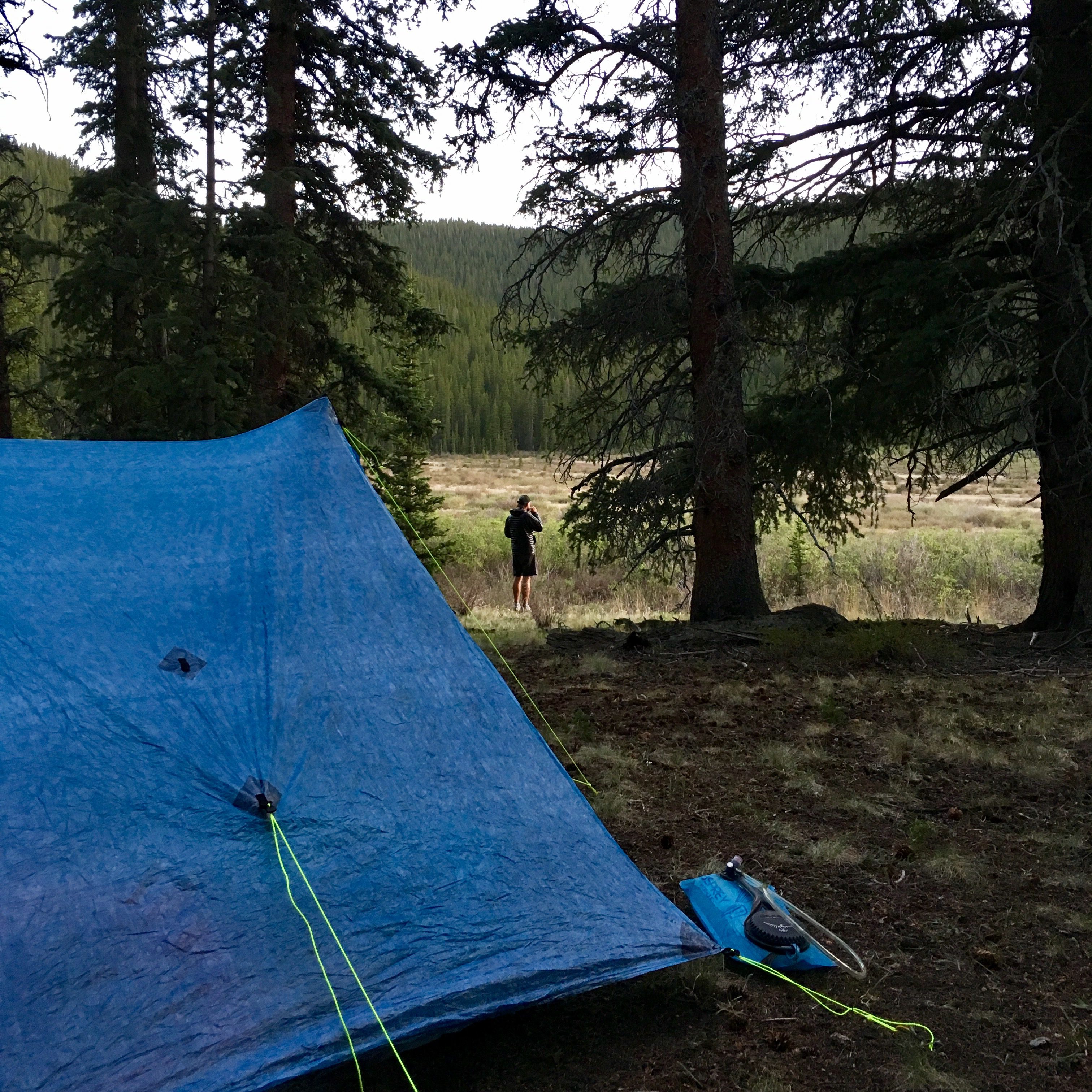
Here are some more pictures. I took about 1000.

Share this:

Filed Under: Hikes, Travel Tagged With: backpacking, hiking, national parks, road trip, travel

Overnight Backpacking Trip In Island In The Sky

May 15, 2018 by Jenna

A 21-mile out-and-back overnight backpacking trip on Lathrop Trail in Canyonlands National Park, Island in the Sky district.

Overnight Backpacking Trip In Island In The Sky

For my birthday weekend this year I decided that I wanted to do a little bit of backpacking. Michael had zero problems with this idea, so we requested off from work and started looking into backpacking options in Canyonlands National Park.

Permits

Island in the Sky backpacking

Airport Tower


We were a little late in the game getting backcountry backpacking permits, so our options were limited for the weekend we were going. However, we lucked out at got permits for the Lathrop Trail in Island in the Sky. April is a very busy time in Canyonlands and Arches and I was so happy that we found something!

Lathrop Trail is a 21-mile out-and-back trail from the top of a mesa down through canyons to the Colorado River. There was a total of about 2100 feet elevation gain/loss.

The last time Michael and I went to Canyonlands was January 2017 (it was our third date!) and we backpacked to Chesler Park in The Needles. We didn’t need to reserve permits in advance since there were approximately 5 other people in the park.

Moral of the story, if you are planning to go backpacking in Canyonlands during peak times, plan ahead and book your backcountry permits months in advance! Probably three months at least.

With that said I was not at all disappointed in the Lathrop Trail.

Here is more information about reserving a backcountry permit in Canyonlands.

Gear

The goal was to pack as light as possible to keep it as easy as possible for me and my heart. In order to do this I needed to swap out some gear and invest in some high quality, ultra light items. I feel very, very fortunate that I received some items as gifts and that I was able to splurge on some things for myself.

The primary swap was the pack. I went from the REI Co-Op Flash 60 (3lbs 5oz) to the Pa’lante V2 pack (1lbs). This lightened my load by 2lbs 5oz. Unfortunately I also lost 20 liters of capacity, but everything I needed fit fine in the Pa’lante Pack.

I also switched out my Feathered Friends Egret UL 20 sleeping bag for the Katabatic Palisade 30 sleeping quilt, which was an amazing birthday gift from Michael. He spoils me. This saved me about 9oz. I still love my Feathered Friends bag and will use it for chillier nights.

I finally remembered to do a gear overlay picture!

Island in the Sky backpacking

  • What I wore: Voormi River Run Hoodie, Athleta Speedlight tank, Champion sports bra, Oiselle Roga shorts, Altra Timp trail runners, Dirty Girl gaiters, Injinji socks, Feral Mountain Co hat, UV Insect Shield Buff, Smith sunglasses
  • Gear: Pa’lante V2 pack, Katabatic Palisade 30 sleeping quilt, Black Diamond trekking poles,  Therm-a-Rest NeoAir XLite sleeping pad
  • Clothes in my pack: Melanzana hoodie, Patagonia rain jacket, leggings, 1 pair underwear, 1 pair of socks
  • Other things: Sea to Summit spoon, empty Talenti container, tooth brush, toothpaste, sunscreen, poop shovel, wet wipes, hand sanitizer, bandana, phone charger, iPhone, a few Hyperlite stuff sacks, Platypus bottle
  • Food: 1-liter Smartwater (x4), a variety of bars, beef jerky, ramen, and oatmeal

Things you don’t see – the tent, because Michael carried it and a stove, because we decided to go stoveless and cold-soak our food.

Since we were hiking in the desert and had no opportunities to filter water (aside from the Colorado River, which is really silty and would probably ruin our filters) we had to carry all of our water with us from the start. Each of us had 6 liters of water (4 1-liter Smaterwaters and a 2-liter Platypus bottle). The water alone was 13lbs for each of us! Typically we’d carry 2 or 3 liters at a time while backpacking and filter water at streams along the way, so this was a lot of extra weight.

Island in the Sky backpacking

Backpacking Day 0

We got into Moab on Saturday afternoon and got a hotel room. We stopped at Moab Brewery for beers and food, went on a hunt for some Old Trapper beef jerky and a few other last-minute supplies, re-organized all of our gear, hydrated like it was our job, and got a good night of sleep.

Island in the Sky backpacking

Backpacking Day 1

After a quick continental breakfast at the hotel we hit the road to Island in the Sky. First stop was the Visitor’s Center to pick up our permits and hear all the rules, most of which we already knew – only sleep where the permit allows, leave no trace, don’t bust the crust, no dogs, have fun, etc. The staff was very knowledgeable!

Afterwards we took off to the trailhead and officially started our backpacking adventure on Lathrop Trail!

The trail starts out at about 6000 feet. The first few miles were spent walking through grassy flat land. I believe this was called Gray’s Pasture. I was a little nervous to be backpacking, so I’m glad we started out nice and easy so that I could calm some of my nerves!

Island in the Sky backpacking

Island in the Sky backpacking

First view of the La Sal Mountains


About a mile in the trail then turns into slickrock and we start heading towards the canyon rim. Here we catch our first views of the Colorado River and Airport Tower.

Island in the Sky backpacking

Island in the Sky backpacking

Then we start the big drop! The trail goes into a series of switchbacks down the side of the canyon and drops about 1500 feet in 1 1/2 miles. Oh boy my legs were shaking by the end of that descent! Trekking poles were a huge help here.

Island in the Sky backpacking

We hiked all the way down from the top of that!


At the bottom there was a nice, flat spot with some good looking sittin’ boulders, so we stopped to take a snack break. Snack breaks are the best.

Island in the Sky backpacking

From there we walked on a little ridge and then dropped down into a dry wash before hitting White Rim Road, which was about 6 miles from the trailhead.

This is where I discovered that my legs were getting FRIED by the sun, so I added more sunscreen.

We then crossed White Rim Road and headed down into Lathrop Canyon to the Colorado River. This section was less of a trail and more of an unpaved four-wheel-drive road.

Island in the Sky backpacking

Over the next 4ish miles down to the river we kept our eyes open for camping spots, since this was the only area we were permitted to set up camp. Everything was at large, so there were no designated spots.

I won’t lie, by this time of the day I was starting to get pretty pooped. The sun was blazing and my pack felt heavy with all the water I was carrying. I think Michael was worried that I wasn’t having a good time, because I was getting quieter. I was having a good time – type 2 fun, obviously – just a little tired. My body wasn’t used to doing this type of stuff anymore. We came across a shady area, so we stopped there for a longer snack break to rest, hydrate, and eat some beef jerky. As I mentioned before, snack breaks are the best! I felt revived after this.

From there it was only about 2 more miles to the Colorado River. I could tell we were getting closer because we started to see a lot more trees and greenery. We kept walking, turned a corner and there it was – the Colorado River!

Island in the Sky backpacking

Island in the Sky backpacking

We stopped to rest here for just a little bit. There was a vault toilet and a picnic table. Also, by this time my legs were so sunburned. I did a terrible job putting on sunscreen, not at all balanced. The back of my legs were completely red, my knees were white, and the rest of my legs were red and white streaks. It looked like they were tie-dyed. #fail. I was so glad that I purchased a Voormi River Run Hoodie right before the trip, which was a light long-sleeve merino wool shirt with UV protection. Otherwise my top half would have matched my bottom half. It didn’t make me feel too hot, so that’s another bonus.

Island in the Sky backpacking

After snapping a few more pics we turned around and started to make our way back about 3 miles to the campsite Michael had scoped out. Michael played some tunes on his phone to keep us pumped up for the next hour of hiking. He could tell I was dragging a bit and offered to carry my pack for the last 1/2-mile. I definitely could have carried it and been totally fine, but I didn’t deny his offer. He’s the best.

We set up our tent as soon as we got to the campsite.

In total we hiked about 13.5 miles total, which is the longest I have hiked since July. My endorphins started to kick in shortly after we stopped and I felt AMAZING.

Island in the Sky backpacking

We reorganized our stuff a little bit, had a snack, and sat in the tent listening to Backpacker Radio. Michael fell asleep in about 4 seconds while I laid there awake, listening to the podcast, and feeling my legs throbbing from sunburn.

After some down time we made dinner, which involved soaking ramen packets in Talenti containers and adding a few packets of Taco Bell hot sauce. This was the first time I ever ate cold-soaked ramen and I was pleasantly surprised at how tasty it was!

It was such a lovely evening – nice and cool with beautiful views. We were the only people there.

Island in the Sky backpacking

A little bit later we decided to call it a night a hit the hay. Again Michael fell asleep in about 4 seconds (I don’t think he is ever happier than he is while he’s sleeping in a tent) while I laid awake watching the stars come out and eventually fell asleep.

Island in the Sky backpacking

Change of Plans

Mid-way through the first day of hiking we started to think about our agenda for the rest of the trip. Our original thought was to backpack 3 days/2 nights. We would hike down to the Colorado River the first day and camp about 2 miles back towards White Rim Road. The second day we were thinking we could hike another few miles up and then spend the day exploring side trails and slot canyons. The third day we would hike back up the canyon and to the trailhead. However, there weren’t a lot of side trails and slot canyons to explore. Our only option was to walk along White Rim Road, which is more of a Jeep and mountain biking road, so it wouldn’t be super exciting.

Since we had made good time the first day (we didn’t really know what my body would be able to handle) we decided to cut the trip short and hike back to the trailhead the next day. We toyed with the idea of getting a car camping site and exploring other areas of Canyonlands, but it was looking as if it was going to be pretty chilly, windy, and overcast. In the end we decided that we would just drive back to the Denver. We both had Tuesday off of work so we would still be able to have a fun day together.

Island in the Sky backpacking

Once we made this decision we started drinking a lot more water. Now our 12 liters only had to last us 2 days instead of 3. Looking back I don’t think we would have made it through 3 days with enough water. We were so thirsty that first night!!

Backpacking Day 2

We woke up the next day at about 7:30. We wanted to get an early-ish start so that we could hike back up the canyon before the sun made us too hot.

We ate a bar for breakfast (didn’t want to use any of our precious water to make oatmeal), packed everything up, and headed out.

Since it was an out-and-back trail we did the same exact hike as the previous day, except opposite. All of day 1 was downhill, which meant that all of day 2 was uphill (approximately 2100 feet of total elevation gain/loss). So great. Fortunately, we had 3 miles less to hike since we had already backtracked a little bit the day before, it was slightly overcast and not as hot, and our packs were lighter due to the food and water we consumed the previous day.

Island in the Sky backpacking

The view down into Lathrop Canyon from White Rim Road


I am currently not supposed to get my heart rate up above 140bpm in order help prevent it from going into any weird rhythms, specifically ventricular tachycardia. (side note: I am going back to Mayo next week and hopefully they will tell me that my blood clot is gone and that I can get the ablation done so that I can be fixed and not have to worry about this anymore. HOPEFULLY.) This means that when going uphill I have to take it pretty easy and move at a slow and steady pace.

The first part of the hike back up to White Rim Road was a little steep, but nothing too bad. Then we had a flat section with some rolling hills. We took it pretty easy and stopped a lot to take pictures. AKA I stopped a lot to take pictures while Michael stood there waiting for me… or taking them for me.

Island in the Sky backpacking

We even spotted a little big horn sheep! Their camouflage is so impressive.

Island in the Sky backpacking

Do you see it?

Then it was time to hike the 1500 feet back up the canyon! But first, we took a Haribo gummi bear snack break.

My pack was much lighter at this point than it was when we were hiking down the canyon the previous day, but obviously it’s more cardiovascularly tolling to hike up than it is to hike down.

Island in the Sky backpacking

The ridge we hiked along


I took my time hiking up. Michael is always so patient hiking behind me. He probably could have hiked up and down and back up again in the same time it took me to hike up once, but he always let’s me set the pace and never complains that I walk too slow.

I did have to stop a few times to let my heart rate drop a little. Fortunately, everything was totally fine and we made it back to the canyon rim.

Luckily Michael helped prep me for this with his seven Sanitas summit challenge.

From there it was a couple miles back through the slickrock and the grassland. Then we were back to the car!

Island in the Sky backpacking

We immediately started chugging Powerade, then changed clothes, slipped on some sandals, and rinsed off our hands. What a glorious feeling! A few minutes later we were on our way back to Denver.

Obviously there was a stop at Slope & Hatch in Glenwood Springs. They have the best tacos.

Side Notes & Comments

Island in the Sky backpacking

  • Up until about 7 miles into the trail we saw 0 people. I was expecting to see a lot more since April is such a busy time in Canyonlands. We came across a couple mountain bikers and people in jeeps (5 total) closer to the Colorado River and spotted one other hiker after we had set up camp. The second day we saw 2 hikers near the canyon rim and some day hikers closer to the trailhead.
  • Here’s a Youtube video of the entire trail (I didn’t make it). I watched it before leaving for our trip. It was fun to see a little preview!
  • The desert is such a magical, mysterious place! You see a fossil and think, “Hmmm… how did that get here?” Then you see all these layers and textures and realize that there is so much history showing through the landscape.
  • Per usual, I packed too much food.
  • I will now forever be paranoid at how I apply sunscreen to my body in fear that I will end up looking tie-dyed again.

It felt so good to get away with Michael for a long weekend, to explore a new place, to sleep outside, and to learn that I can handle backpacking. Overall, it was a wonderful trip and a great way to spend my last few days as a 30-year-old.

And, of course, a few more pictures…

Island in the Sky backpacking

Island in the Sky backpacking

Island in the Sky backpacking

Island in the Sky backpacking

Island in the Sky backpacking

Share this:

Filed Under: Hikes, Travel Tagged With: backpacking, camping, canyonlands, hiking

Quick Camping Trip in Eagles Nest Wilderness

July 11, 2017 by Jenna

A rare Saturday night and Sunday morning with no other commitments led to a spontaneous (and quick!) camping trip to Eagles Nest Wilderness.

Camping in Eagles Nest Wilderness

On Friday afternoon I shot Michael a text, “Throwing this out there: We could camp somewhere not too far away Saturday night and hike Sunday morning.” It didn’t take much to convince him that this was a great idea.

Next came the planning.

Turns out I’m pretty bad at it. There are just so many options for camping here in Colorado! It’s overwhelming. We were looking for an area that was less than 2 hours from Denver with 10-15 miles of hiking trails, minimal snow, and no permit/reservation required. After a lot of Googling and a trip to REI to ask the experts, we landed on a 10ish-mile backpacking loop in Eagles Nest Wilderness, just outside of Silverthorn.

And by “we”, I mean Michael. He’s the one that first came across Eagles Nest Wilderness and went to REI while I was working at the Brewery Running Series event at Cerebral Brewing.

I got home from the event, packed up my gear, and we were on the road by 3:00!

eagles nest wilderness

Eagles Nest Wilderness Gear

Since we were just backpacking for one night our packs were much lighter than they were in Lost Creek Wilderness. Here’s what I brought with me:

  • Gear: REI Traverse 48-liter pack, 20-degree sleeping bag, Therm-a-rest NeoAir sleeping pad, Black Diamond trekking poles, Etekcity camp stove, fuel, Sea to Summit long camp spoon, Etekcity water filter, Platypus bottle, Osprey 3-liter bladder, 1-Liter Smartwater, lighter
  • Toiletries: toothpaste, toothbrush, sunscreen, hand sanitizer, toilet paper, wet wipes, poop shovel.
  • Food: ramen noodle packet, tuna pouch, skratch hydration, instant coffee, oatmeal baggie (oats, protein powder, cinnamon)
  • Clothes I packed: Patagonia rain jacket, Mountain Hardwear puffy coat, long-sleeve shirt, leggings, 1 pair underwear, 1 pair of socks, hat
  • What I wore:  Patagonia Happy Hike shorts, Grandma’s Marathon t-shirt, Saucony Peregrine trail runners, sports bra, socks, sunglasses

I also packed some trail mix and protein bars that I didn’t eat.

eagles nest wilderness

Saturday Evening in Eagles Nest Wilderness

We parked our car at the Eaglesmere Trailhead (8700 ft) shortly before 5:00pm. It’s a little late to start heading out on a backpacking trip, but better late than never!

We walked along the gravel road to the Surprise Trailhead, crossed over the Cataract Creek, and headed onto the trail and into the forest. It was full of aspens, wildflowers, mosquitoes, and uphill hiking.

2 of the 4 things in that list were not so great. I’ll let you guess which ones.

eagles nest wilderness

I hope you guessed the mosquitoes and the uphills.

Luckily we put some deet on before starting the hike. Otherwise, we easily could have gotten eaten alive.

As for the uphill climb, I was on the strugglebus. I’m not sure if it was from the elevation, the climbing, or slight dehydration, but I was pretty light-headed for miles 2, 3, and 4. It didn’t feel great. I had to slow my pace way down and continue to suck down water.

eagles nest wilderness

Just over 3 miles into the hike we hit the split for Gore Range Trail. We took a right onto the trail and passed by Surprise Lake (10,050 feet). Since we were tight on time (and I was dragging my feet) we didn’t stop to gawk at the lake. I’m sure it was beautiful though. There was quite a few people camping near there. Maybe we’ll catch it next time.

We continued to hike on the Gore Range Trail. We crossed over a lot of fallen trees, rolling hills, and streams from mountain run-off. A few miles later we hit the Tipperary Lake Trail split. Our original plan was to camp at Eaglesmere Lake, but considering that it was already 7:00 and Eaglesmere was another 2 miles away we decided that Tipperary Lake was going to be our home for the night.

Tipperary Lake was about .1 miles from the trail split. It’s a small and marshy lake at about 9,770 feet.

eagles nest wilderness

A group of three men had already set up camp near the lake and had invited us to join them, which was great, because there were not many other options. We changed into warmer clothes, set up camp, and started up cooking dinner (ramen and dehydrated vegetables, classic). Michael pulled a chocolate bar and a little bottle of bourbon out of his pack. What a lovely surprise! He’s the best.

We ate, drank, and chatted with our camp neighbors. One of the men had been coming to camp at Lake Tipperary in Eagles Nest Wilderness for 25 years! So crazy!

We hung out and relaxed as the sun went down and the stars went up. It was a beautiful evening.

eagles nest wilderness

Sunday Morning in Eagles Nest Wilderness

We woke up on Sunday morning at about 7:30 to a gorgeous day! Can’t complain about waking up to views like this:

eagles nest wilderness

I cooked up my oats and ate breakfast on a boulder overlooking the lake. It was so peaceful. We finished packing up camp and hit the Gore Range Trail shortly after 8:30. Since we did most of the work (AKA uphill hiking) the previous day, our hike north to the Eaglesmere Trailhead was going to consist of some rolling hills and a lot of hiking down.

The landscape of Sunday’s hike was vastly different from Saturday’s. On Saturday we were primarily hiking through groves of tress with very little scenic views. On Sunday we were traversing through more open areas that exposed us to beautiful views of Lower Cataract Lake and Green Lake Reservoir. Also, there were a lot less bugs!

eagles nest wilderness

We were able to hike quickly and made it back to our car by 10:30.

The full loop was about 10.4 miles (5.5 miles on Saturday and 4.9 miles on Sunday) ranging in elevation from 8,700 feet to 10,300 feet. It was much less intense that our previous backpacking trip in Lost Creek Wilderness, but still totally worth it.

I love that we can decide late on Friday afternoon to go on camping trip and make it happen. Even though it was only 10 miles and one night, both of us came back to Denver on Sunday revived from hiking, breathing in fresh mountain air, watching the stars come out, and sleeping outside.

I highly recommend spending some time in the Eagles Nests Wilderness! I would love to go back and explore more of the area.

eagles nest wilderness

Share this:

Filed Under: Hikes Tagged With: backpacking, camping, colorado hikes, hiking

45-Mile Backpacking Trip in the Lost Creek Wilderness

June 27, 2017 by Jenna

The wilderness was calling. Neither Michael nor I had been backpacking since we went to Moab in January. We were way overdue for an overnight outdoor adventure, so we picked a weekend, took off work, and started planning a trip in the Lost Creek Wilderness.

45-Mile Backpacking Trip in the Lost Creek Wilderness

The original idea was to head down to Salida to camp and hike a couple 14ers (Shavano and Tabeguache, maybe Antero); however there was quite a bit of snow on the mountains, so we tabled that idea for another weekend.

Michael planned out a 45ish-mile loop for us to hike in 3 days. 45-MILE LOOP. This would definitely be the most hiking I’ve ever done. So far this year, I’ve gotten in a few 17-20 mile hikes, but those were just day hikes where I was carrying a small pack with some snacks and water and then went home to sleep in my comfortable bed afterwards. This would be carrying a pack full of camping gear and food, sleeping in a tent, and waking up for another full day of hiking (x2).

Somehow, it all seemed way more exciting than it did daunting. I knew Michael wouldn’t put me through something he didn’t think I could do, so I was all in.

This was our route:

lost creek wilderness 45-mile trail map

Lost Creek Wilderness Packing

Having hiked the PCT, the Colorado trail, and a portion of the CDT, Michael is expert on packing for adventures like this. As someone who tends to over-pack, I needed his help.

I laid out all my gear and let him walk through it. He took out my deodorant and soap (because we’re both going to smell anyways), gifted me a lovely poop shovel, and let me borrow his lightweight Therm-a-rest pad and old hiking poles.

Here is what I ended up with after the shakedown:

  • Gear: REI Traverse 48-liter pack, 30-degree sleeping bag, Therm-a-rest NeoAir sleeping pad, Black Diamond trekking poles, Etekcity camp stove, fuel, Sea to Summit long camp spoon, Etekcity water filter, Platypus bottle, Osprey 3-liter bladder, 1-Liter Smartwater, lighter
  • Toiletries: toothpaste, toothbrush, sunscreen, hand sanitizer, toilet paper, wet wipes, poop shovel, ibuprofen.
  • Clothes I packed: Patagonia rain jacket, Mountain Hardwear puffy coat, light long-sleeve shirt, leggings, 1 pair underwear, 1 pair of socks, hat
  • What I wore: sports bra, tank top, Athleta Trekkie shorts, socks, Saucony Peregrine trail runners, UV Insect Shield Buff, sunglasses

The plan was to hike in the same clothes every day and wear the items in my pack while at camp. Michael carried the tent in case you were wondering where that important piece of gear was hiding.

Based on long marathon training runs and longer hikes, I know that I typically need a snack every 4-5 miles (~2 hours) to avoid bonking. I assumed 8 hours of hiking per day, along with 2 breakfasts and 2 dinners and ended up with:

  • Breakfasts: instant oatmeal packet (x4), instant coffee (x2)
  • Dinners: ramen noodle packet (x2), salmon pouch (x2)
  • Hydration: 3 Nuun tablets, 4 Scratch packets, 3 Crystal Light packets
  • Snacks: 3 packets Justin’s nut butter, 6 bars (variety of brands like this and this), 3 small baggies of trail mix, and 3 packets of gummies/energy chews.

I either packed too many snacks or didn’t eat enough throughout the day, because I didn’t eat a packet of Justin’s, 3 bars, a bag of trail mix, and a packet of energy chews. I’d rather have a few snacks leftover than not have enough to eat, but it also would have been nice to carry a little less weight. It’s a fine line, but is something I’ll learn with time.

Lost Creek Wilderness Day 1:

Michel and I left Denver for our backpacking adventure in the Lost Creek Wilderness adventure early Saturday morning, a 2-hour drive. We started a little after 10:00am from the Goose Creek Trailhead (8,200 feet elevation) and headed west on the Hankins Pass Trail. Our plan for the day was to get in at least 15 miles, hoping to hit closer to 17-18 miles.

lost creek wilderness

The weather was warm with bright blue skies and a nice, cool breeze. It was pretty ideal; however, I was struggling. It took me a while to get adjusted to carrying a heavy pack, utilizing trekking poles, and hiking at 8,000+ feet of elevation. Not to mention the trail was basically up and up and up the entire day. I was breathing heavy and was slightly uncomfortable, but I kept chugging along putting one foot in front of the other knowing that it would (hopefully?!?!) get easier.

We took our first break after about 4.5 miles at the junction for Lake Park Trail (10,000 feet elevation). Despite the difficulties I was still all smiles.

lost creek wilderness

Lake Park Trail started taking us north and kept us climbing up (11,560 feet elevation) and down through aspens, pines, and red rock formations until we reached the Brookside-McCurdy Trail (10,750 feet elevation). From here we continued heading north and heading up. We reached an old burn area with views of Bison Peak, McCurdy Mountain, and more distant mountains.

lost creek wilderness

lost creek wilderness

At this point we were about 14 miles in and I was definitely feeling the hike and the elevation. We stopped for a quick electrolyte and snack break and prepared ourselves for the final push of the day, a climb up to 11,900 feet.

The views were so spectacular. I had tears in my eyes, which could have been caused either by the beautiful views of Pikes Peak or by the wind whipping across my face.

lost creek wilderness views of pikes peak

It was all down hill from there. Literally. Within a few miles we dropped down to about 10,000 feet and ended at a little creek. We stopped to fill up our water and began keeping our eyes peeled for a spot to set up camp… and for moose. At this point we were wandering through a bunch of willow bushes and came across a lot of moose droppings. But alas, no moose 🙁

After another mile(ish) of searching we found a spot and started setting up camp. We put on our warm clothes, cooked dinner, brushed teeth, took some Advil PM, and climbed into the tent.

lost creek wilderness

I officially survived Day 1!

Day 1 Stats: 18 miles; 4,400 feet elevation gain

Lost Creek Wilderness Day 2:

We woke up at about 8:30am to another beautiful day! After rolling out of the tent, we began cooking breakfast, taking down the tent, and getting ready for the day.

Breakfast was two packets of instant oats mixed with instant coffee and some goji berries and mullberries. Yum!

lost creek wilderness camp breakfast

We hit the trail at 9:30am with a planned stop at the Lost Park campsite to use the facilities (no offense, poop shovel) and fill up on water. From there it was 2 miles until we connected with the Colorado Trail and started heading east. Michael hiked the entire Colorado Trail last summer and was reliving some memories. I love hearing about his adventures and try to not get too jealous while I’m listening. Maybe one day I’ll get to hike the entire trail.

Colorado Trail

I was feeling ok at the start of Day 2. Despite all the previous day’s climbing, my legs felt surprisingly great and my shoulders were only a little sore. However, my pack felt super uncomfortable on my back, almost like a sharp pain from my left shoulder-blade to my neck. We were in the middle of a short climb (about 500 feet) and I absolutely had to stop to make some sort of adjustment. I took off my pack and found a pea-sized rock lodged by the zipper just about my left shoulder strap. That was the little rock was the cause of all my pain! I felt infinitely better after that. I cannot begin to describe how relieved I was.

Again, all smiles at our snack break.

lost creek wilderness

The Colorado Trail led us on an old logging road through aspens and ponderosa pines, where we dropped about 2,000 feet over 6 miles to about 8,400 feet. We took advantage of the easy hiking and moved quickly, because our goal was to reach 20 miles.

Colorado Trail

From the Colorado Trail we got onto Rolling Creek Trail and started heading south. The trail was pretty gentle, so we continued to hike quickly. About a mile into Rolling Creek Trail we stopped for a quick bio break. I peeled off my pack and revealed two large blisters at the top of each collarbone. This will teach me to wear a tank top while carrying a heavy pack! Michael put moleskin and tape over each blister and I changed into a t-shirt.

I’m such a rookie.

After another mile of nice and easy hiking the trail crossed Rolling Creek and then went straight up. This is not an exaggeration. The trail was STEEP. We gained about 2,200 feet in about 2.5 miles. The first mile or so was through a gorgeous canyon, but I was too busy charging up the mountain to stop and take any pictures.

I just took mental pictures, please believe me when I tell you it was stunning.

At the top of the canyon we took a much needed water and sugar break – Sour Patch Kids ftw!! We then continued on switchbacks and headed up and up. About a half-mile from the top we were both out of water. I was running on sugar and adrenaline alone and actually felt pretty good. We made it to the top (10,650 feet elevation), high-fived each other, and immediately started going down, dropping 1,000 feet in a little over a mile.

This is about when I realized I was in love with trekking poles. They helped me hike swiftly during the flat parts of the trail, helped me stay upright and led to easier climbing on the steep uphills, and helped steady me and ease the pressure on my knees during the descent. I guess it’s just one more piece of equipment I need to invest in!

We eventually made it down to Wigwam Park (<- best name) and found a spot to camp next to a little creek.

lost creek wilderness

Michael and I were both drenched in sweat, so we immediately changed into dry clothes and hung our sweaty ones out to dry. I felt like I did after my 20-mile training runs – sweaty and drained, yet full of endorphins. It’s an odd combination.

Michael set up camp while I filtered water and then we followed the same routine as the previous night – cook dinner, brush teeth, take Advil PM, and crawl into bed.

It was ramen noodles and salmon for me, while Michael had bougey Pad Thai.

lost creek wilderness camp dinner

Day 2 was complete! I think we passed out by 9:00pm.

Day 2 Stats: 20 miles; 3,100 feet elevation gain

Lost Creek Wilderness Day 3:

We woke up at about 9:30am to our final day of hiking! Having already covered 37 miles we only had about 10 miles of rolling hills to go and planned to knock them out quickly.

Our hiking clothes were still slightly damp with sweat, so we moved them into the sun, crossed our fingers, and hoped that they would be dry after we ate breakfast and packed up camp. Thankfully, they were.

No one likes putting on a sweaty sports bra.

We hit the trail by 10:30am, heading east on the Wigwam Trail along some beaver ponds. After about one-half mile we turned south on Goose Creek Trail. From here is was a short 9.4 miles back to the car.

“Short” is relative. Compared to the previous days of 17- and 20-milers, 9 miles felt like nothing.

lost creek wilderness

The trail began with a 650-feet incline over about 2 miles. There was less “pep in my step” (as Michael put it) on this day, but I still felt pretty good overall – just a little pokey. From there it was rolling hills and gorgeous views down to the Goose Creek Trailhead. We took some very quick breaks (less than 2 minutes quick) here and there to take pictures, but basically charged through the miles.

lost creek wilderness

And then… we made it!!

Michael mapped and tracked everything using the Gaia app. Our total stats according to the app were:

  • Total distance: 46.85 miles
  • Ascent: +8,572 ft
  • Descent: -8,652 ft

Sometimes we didn’t pause it on breaks. Sometimes we did. Sometimes we forgot to re-start it. All in all, we probably hiked a little over 47 miles in 51 hours (including sleep and breaks).

Not too shabby for my first 3-day backpacking trip.

lost creek wilderness

After getting off the trail, we put on sandals (the most relieving feeling ever), hopped in the car, and headed back to Denver with a pit stop for Gatorade, because: dehydrated.

We celebrated the amazing weekend with long showers, steak salads, beer, and conversations about future adventures.

Lessons Learned in the Lost Creek Wilderness:

As a newbie at this whole backpacking thing, I learned a lot of lessons.

  1. Wear a t-shirt (or a muscle tank) to help eliminate collarbone blisters.
  2. When filtering water do not put the cap of the container that holds the dirty water onto the cap of the container with the clean water unless you want to risk getting giardia.
  3. Be careful when taking off hiking shoes at camp, because you might step in a bunch of burs. If you step in burs and try to put on leggings, burs will line the inside of your leggings and you will spend the next 15 minutes trying to pick them all off. The smarter idea is to change in the tent.
  4. A 3 lb 6oz sleeping bag is heavy and takes up a lot of space in a backpack. Either live with that weight or return it and splurge on one from Feathered Friends that only weights 1 lb 12 oz.
  5. Trekking poles are life savers.

Those are just the obvious ones.

Lost Creek Wilderness

I would strongly recommend a backpacking trip in the Lost Creek Wilderness. We covered 47 miles, but there are 130 miles of trails to explore ranging from shorter day hikes to longer backpacking trips. Reach more about the different trails here.

Overall, it was an incredible weekend. I’m so glad Michael and I could get away and spend 3 days out in the wild. It was full of challenges (heavy pack, high mileage, steep climbs) and many rewards (quality time with Michael and nature, beautiful views). I’d go again in a heartbeat and look forward to many more adventures like this to come!

lost creek wilderness

Share this:

Filed Under: Hikes Tagged With: backpacking, camping, colorado, hiking

  • « Previous Page
  • 1
  • 2
  • 3

hello and welcome!

my name is jenna, but you can call me j.faye. i am a lover of food, mountains, and sunshine. read more…

Follow Me

  • Bloglovin
  • Facebook
  • Instagram
  • Pinterest
  • Twitter

Never Miss A Post

receive updates via email:

Instagram

jenna.faye.ivey

Thankful for this crew ❤️ Thankful for this crew ❤️
Winter mode: activated. #snow #winter #mountains Winter mode: activated. 

#snow #winter #mountains #mountainlife #getoutside #outdoors #coloradohikingmoms #keepthelittleswild #liveferal #boymom #colorado #outdoorkids
Hike-or-treat & trunk-or-treats! It was a fun Hall Hike-or-treat & trunk-or-treats! It was a fun Halloween week with our little Mickey 🎃
The leaves. The views. The company! What an incred The leaves. The views. The company! What an incredible experience for our first two-nighter and last camping trip of the year (probably).

Thanks to @adventuresinnoticing & @anni_martini for being amazing friends/aunties. 

#colorado #camping #fall #leafpeeping #mountains #keepthelittleswild #coloradohikingmoms #feraldenver #outdoorsymom #boymom #dogmom #getoutside #lifeoutdoors #lifeofadventure
Cozy season is officially here ✨ #fall #cozy #cam Cozy season is officially here ✨

#fall #cozy #camping #keepthelittleswild #coloradohikingmoms #getoutside #lifeofadventure #motherhood #family #boymom #dogmom #outdoorsymom #rimby #coloradomom
My open heart surgery was 7 years ago and it’s an My open heart surgery was 7 years ago and it’s an anniversary I will never not celebrate. 

I carried a lot of trauma with me for a long time. I was nervous for every hike, every workout, religiously checking my heart rate, wondering if this would be the time my heart fails me again. Very dramatic, I know. But I kept at it, doing these things I love to do, working through the fear. Now the intrusive thoughts are few and far between. 

So here I am 7 years later, a stronger person both physically and mentally, hanging out at the top of a mountain with my babies after a nice, challenging hike.  It’s all I really want. 

I’m so grateful for this life and for the people who continue to support me ❤️

#openheartsurgery #heartwarrior #myocardialbridge #heartattacksurvivor #recoveryjourney #celebrate #adventure #lifeoutdoors

Copyright © 2026 · Foodie Child Theme by Shay Bocks · Built on the Genesis Framework · Powered by WordPress